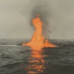
What if the trees around volcanoes could warn us about upcoming eruptions? Scientists have discovered an amazing new way to predict volcanic activity by watching how tree leaves change color near these dangerous mountains.
According to research reported by ScienceAlert, this groundbreaking approach uses satellite technology to monitor vegetation health as an early warning system for volcanic eruptions.
How Trees Become Volcano Detectors
The science behind this discovery is surprisingly simple yet incredibly clever. When volcanoes become more active deep underground, they release higher amounts of carbon dioxide gas into the surrounding soil and air. This extra carbon dioxide acts like a natural fertilizer for nearby trees and plants, making their leaves grow greener and healthier than usual.
Think of it like giving plants a vitamin boost. Just as you might feel more energetic after taking vitamins, trees become more vibrant when they receive additional carbon dioxide. This happens because plants use carbon dioxide during photosynthesis, the process where they make their own food using sunlight.
Nicole Guinn, a volcanologist from the University of Houston, explains that many satellites can be used for this type of analysis. The research builds on earlier work from 2019 and focuses on developing more accurate early warning systems for volcanic eruptions.
The Technology Behind the Discovery
Scientists use a special measurement called the Normalized Difference Vegetation Index, or NDVI for short. This technical term might sound complicated, but it works in a simple way that anyone can understand.
- NDVI measures plant health by looking at how light reflects off vegetation. Healthy plants reflect more near-infrared light and absorb more red light, creating higher NDVI values that satellites can detect from space.
- Satellite cameras capture these light differences to create detailed maps showing which areas have healthier vegetation. When trees near volcanoes become greener due to extra carbon dioxide, the satellites notice these changes.
- The process works like taking a health photograph of forests from space. Just as a doctor might use special equipment to check your health, scientists use satellite technology to check the health of trees around volcanoes.
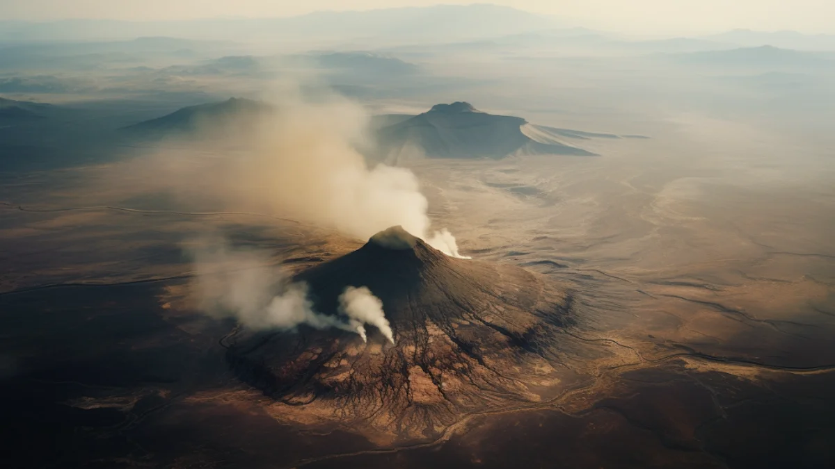
What Researchers Found at Mount Etna
The research team conducted a two-year study around Mount Etna in Italy, one of the world’s most active volcanoes. Their findings revealed remarkable patterns that could change how we predict volcanic eruptions.

| Carbon dioxide spikes detected: Researchers identified 16 distinct increases in carbon dioxide levels that matched perfectly with underground magma movements. |
| NDVI changes observed: Each carbon dioxide spike corresponded with measurable increases in vegetation greenness, proving the connection between volcanic activity and plant health. |
| Geographic scope: The study expanded to include volcanoes in Costa Rica and Panama, showing this method works in different environments and climates. |
Josh Fisher, a climate scientist from Chapman University, emphasizes that researchers are interested in both aspects of this phenomenon: using tree responses as an early warning system and understanding how much carbon dioxide trees can absorb from volcanic emissions.
Why This Method Has Important Limits
While this discovery is exciting, scientists want everyone to understand its limitations. Robert Bogue from McGill University points out that volcanoes releasing modest amounts of carbon dioxide might not show up clearly in satellite imagery.
- Tree coverage problems: Many volcanoes don’t have enough trees nearby to make this method useful. Desert or rocky volcanic areas won’t work with this approach.
- Weather interference: Factors like fires, storms, and plant diseases can change leaf colors for reasons unrelated to volcanic activity, making interpretation difficult.
- Supporting role only: This method serves as an additional tool rather than replacing established prediction methods like seismic monitoring and ground deformation measurements.
Current satellite methods can only detect major eruptions after they begin, making this vegetation-based approach particularly valuable for catching early warning signs that other methods might miss.
This research represents a significant step forward in volcano science, offering a new perspective on how nature provides early warning signals. As scientists continue developing this technology, it could help protect millions of people living near active volcanoes worldwide.